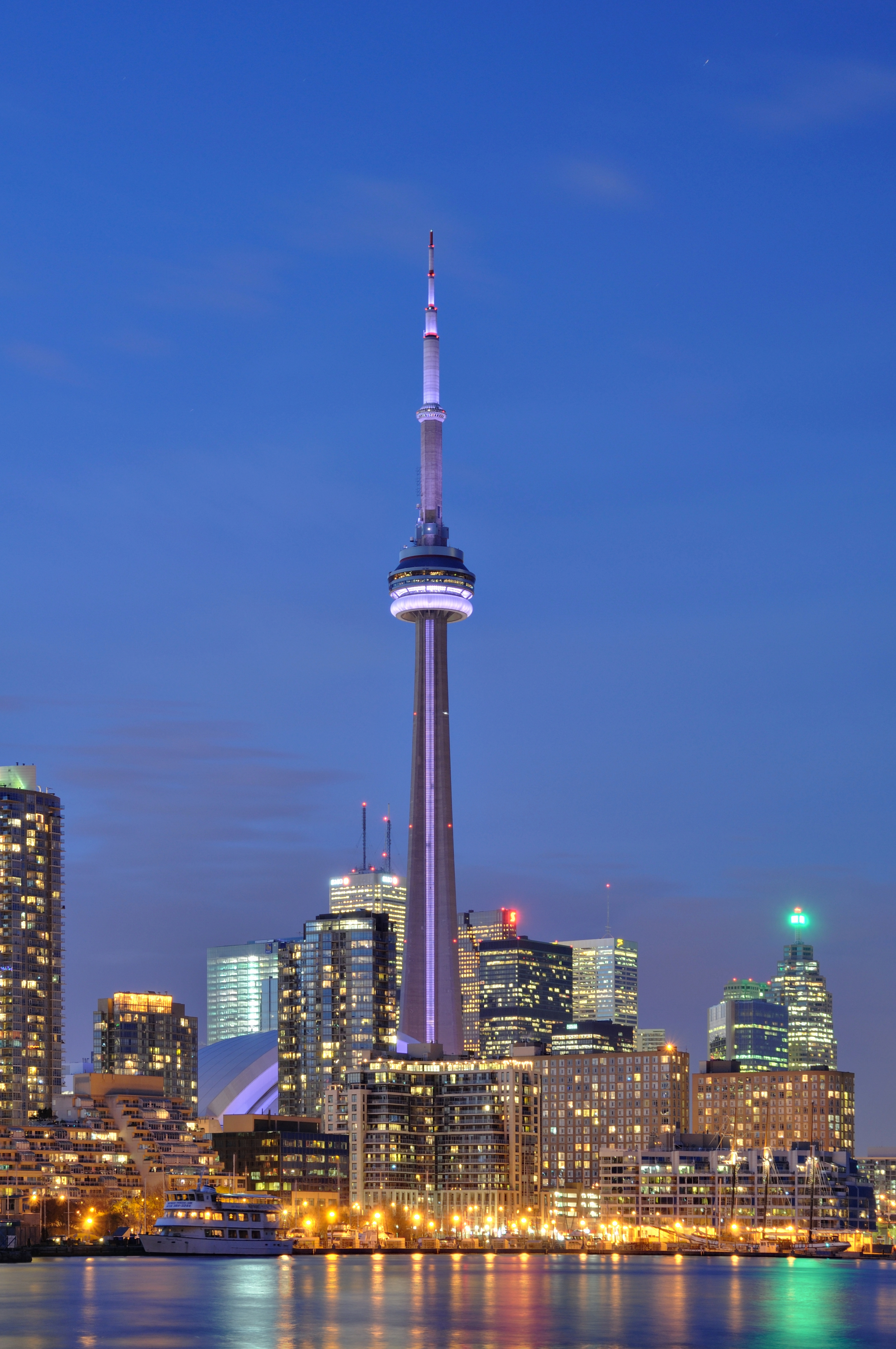
A Skyline Built Around the Core
The skyline's densest concentration developed in the financial district, where office towers clustered around transit, legacy rail lands and premium commercial addresses. From there, high-rise growth expanded west into CityPlace and east toward mixed-use redevelopment zones.
Unlike polycentric skylines with several equal peaks, Toronto's silhouette still reads as a dominant downtown core with supporting secondary clusters. That coherence makes the skyline especially legible from the lake, where foreground water and low harbor edges heighten the contrast.
Toronto's skyline works best from a distance because Lake Ontario supplies a broad viewing apron. Few North American downtowns enjoy such a clear foreground plane.
Why the CN Tower Still Dominates
Even as supertall residential towers multiplied, the CN Tower remained visually supreme because of its extraordinary height, freestanding form and placement near the center of the downtown composition. It is both object and reference point: a landmark against which all surrounding buildings are measured.
The tower's slim shaft also prevents visual crowding. Dense neighboring buildings create a textured base, but the CN Tower escapes the cluster and reads cleanly against open sky, especially from the islands, the waterfront trail and long east-west approaches.
- Extreme vertical separation from surrounding towers
- Central position near rail corridor and sports-entertainment precinct
- Clean silhouette that remains identifiable in haze, dusk and nighttime lighting
Harborfront and Island Perspectives
The classic skyline image comes from across the inner harbor or the Toronto Islands, where distance compresses downtown massing into a single recognizable wall of towers. Ferries, marinas and parkland in the foreground soften the urban edge and make the city appear almost theatrical.
These views matter culturally because they are how many residents and visitors first understand Toronto as a lake city rather than an inland grid. The skyline is inseparable from the waterline; remove the lake and the image loses much of its depth and civic drama.
Morning and late-afternoon light often model the skyline best from the islands, because the lake foreground helps separate tower forms without flattening them.
Condominium Growth and the New Vertical City
Since the late twentieth century, residential towers have transformed Toronto from a primarily office-dominant skyline into a mixed-use vertical city. Thousands of condominium units introduced a finer-grained forest of slabs and point towers around the traditional financial core.
This changed not only the shape of the skyline but also its daily rhythm. More people now live within the skyline image itself, making the downtown silhouette a place of residence rather than a purely commercial façade.
- Office towers define the historic central business district
- Condominium towers extend skyline density south and west
- Mixed-use podiums connect vertical growth to retail, streets and transit
Skyline as Identity and Branding
Toronto uses its skyline constantly in tourism, film, real-estate marketing and civic storytelling. The image communicates scale, economic confidence and metropolitan modernity without requiring explanation, especially when the CN Tower is present.
Yet the skyline also compresses complexity. It can conceal neighborhood diversity, industrial history and social inequality behind a polished exterior. For that reason, the most useful skyline reading is both visual and critical: admiration for the silhouette, coupled with attention to the urban systems beneath it.